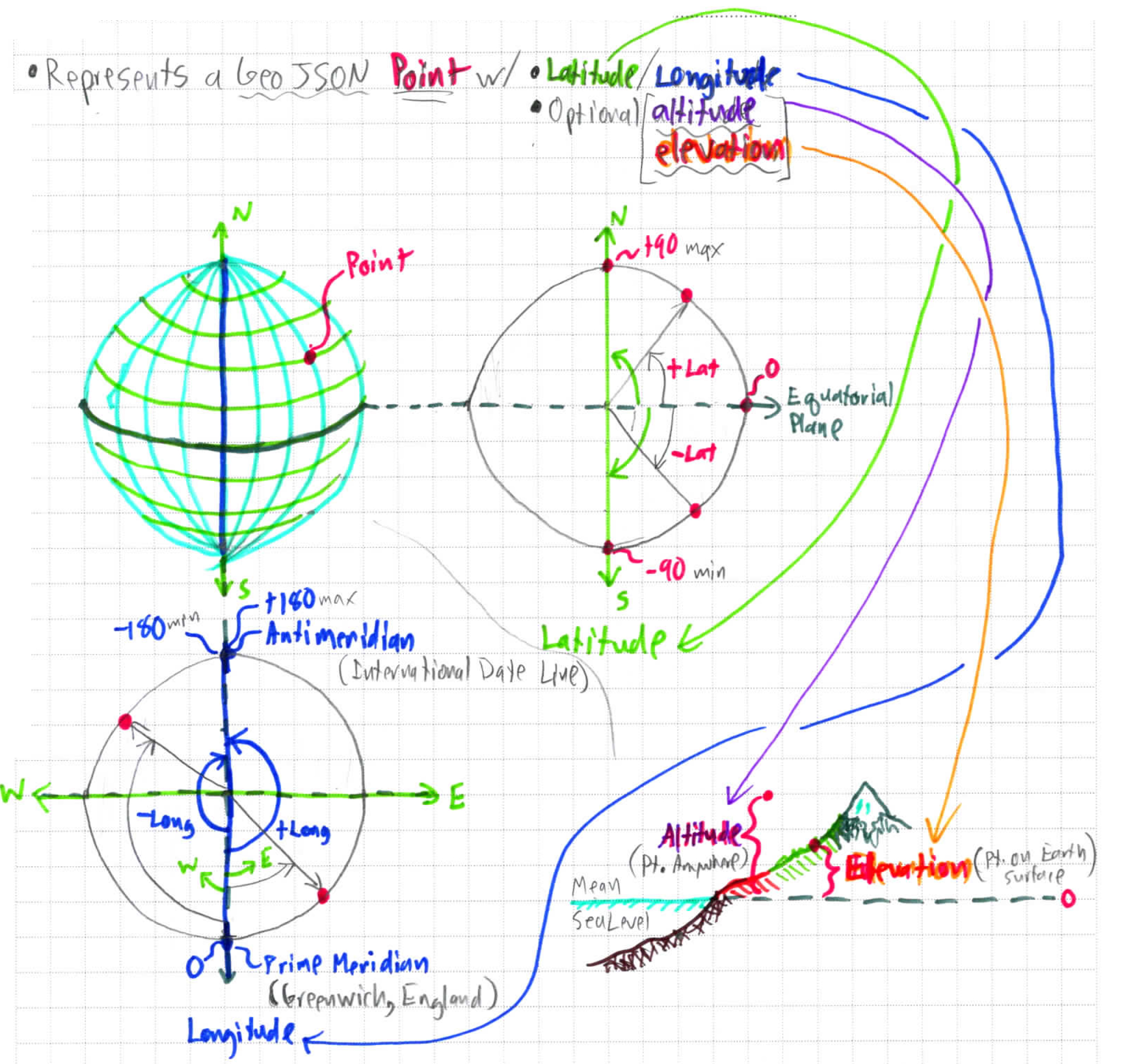
Points are the most basic unit of GPS recordings & any shape or line drawings projected onto maps. GeoJSON points are used in the application.
GPS recordings report altitude, as it may be measured by satellites or barometric pressure & may be recorded for aerial flight.
Elevation must be ascertained from an external source of measured/derived surface data, corresponding to Lat/Long geographical coordinates, such as can be found in Digital Elevation Maps (DEMS).
