Sections
Problem
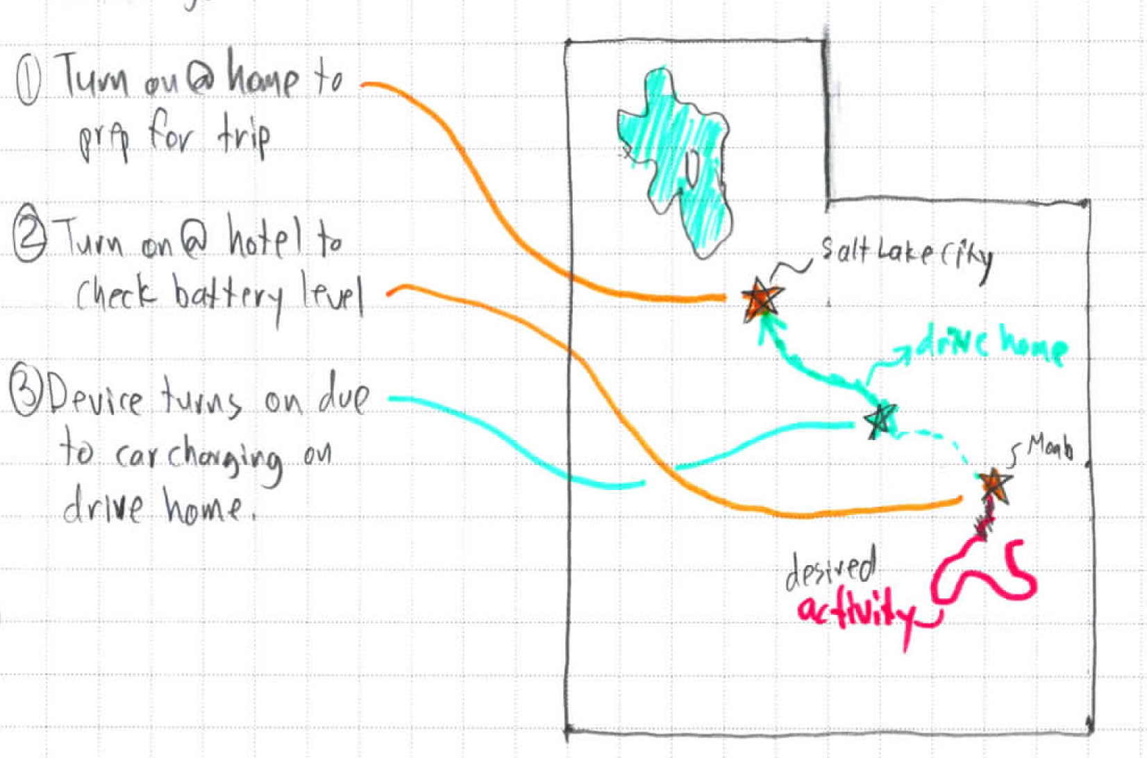
Cruft is unwanted GPS data that is recorded when a GPS device merges multiple recorded periods into a single Track, often picking up periods when the device is turned on but not meant to be recording, such as when:
charging
syncing
checking device battery levels
This results in a MultiLineString when the resulting GPX file is converted to a GeoJSON format. LineStrings that are considered cruft should be removed from the Track.
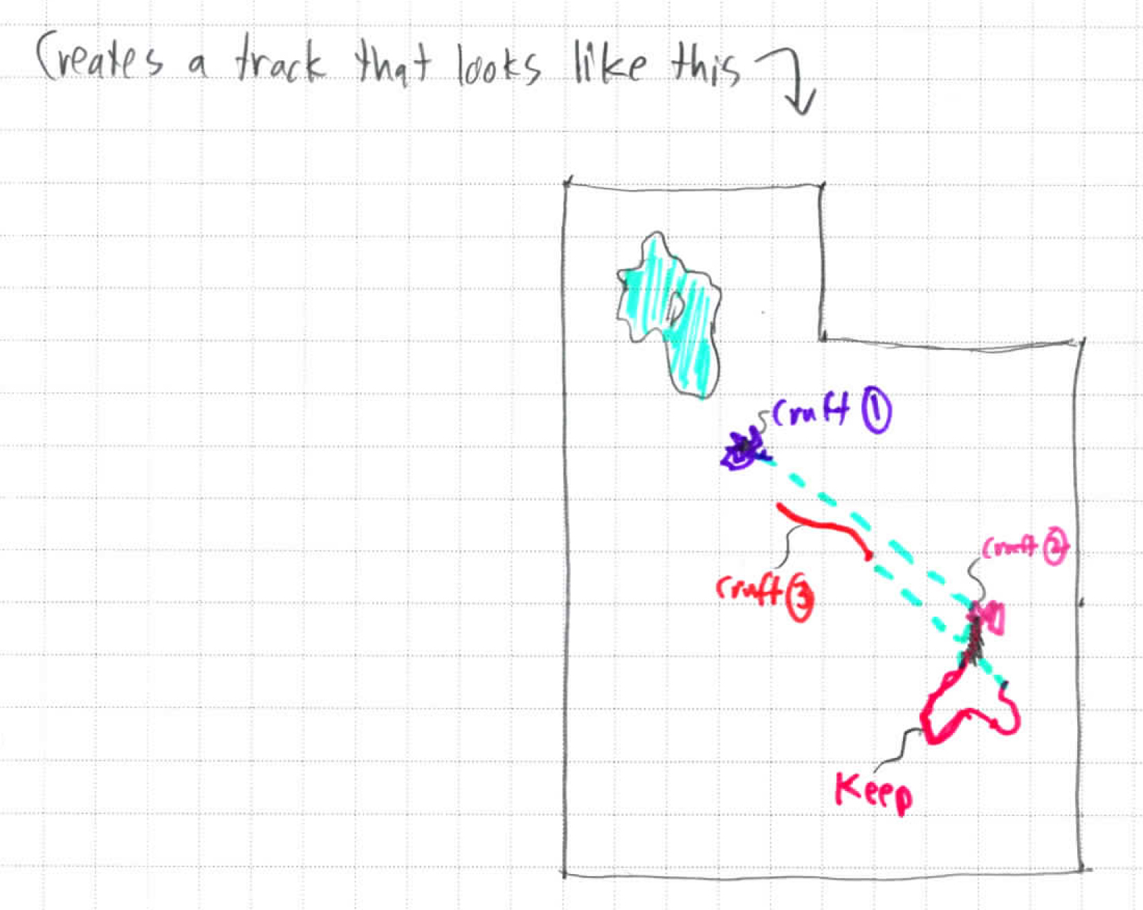
The above diagram shows an example case of how cruft may be recorded. The diagram below shows the Track that ends up recorded. Some programs such as Google Earth will draw lines between the different LineStrings.
Typically, the user will want to remove Cruft 1, 2 & 3 in the diagram above, keeping only the keep movement indicated.
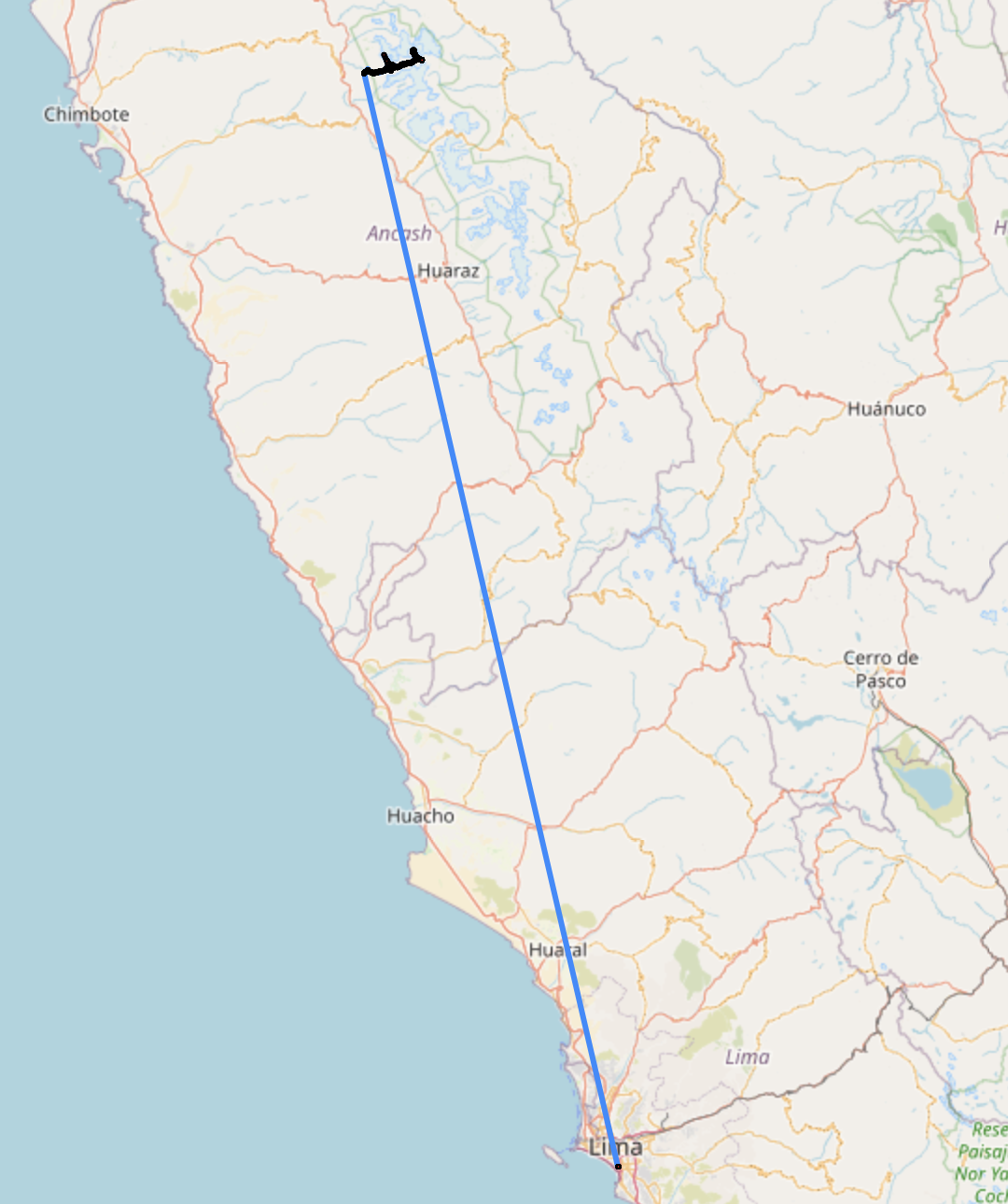
Below is an example of cruft recorded in a GPS track from when the Garmin device was charged & set up in Lima, before being used to record a hike in the Cordillera Blanca.
Solution
Cruft is determined by finding Track Segments that exceed a distance threshold. When this is triggered, the Track is split on this segment. In the fully automated action, the cruft portion is also dropped.
This portion currently is naively assumed to be the one with fewer vertices. Future versions may add some other considerations that may make this guess more reliable. For now, if the wrong Track is dropped, use the preview or undo actions in the app.


