Sections
Problem
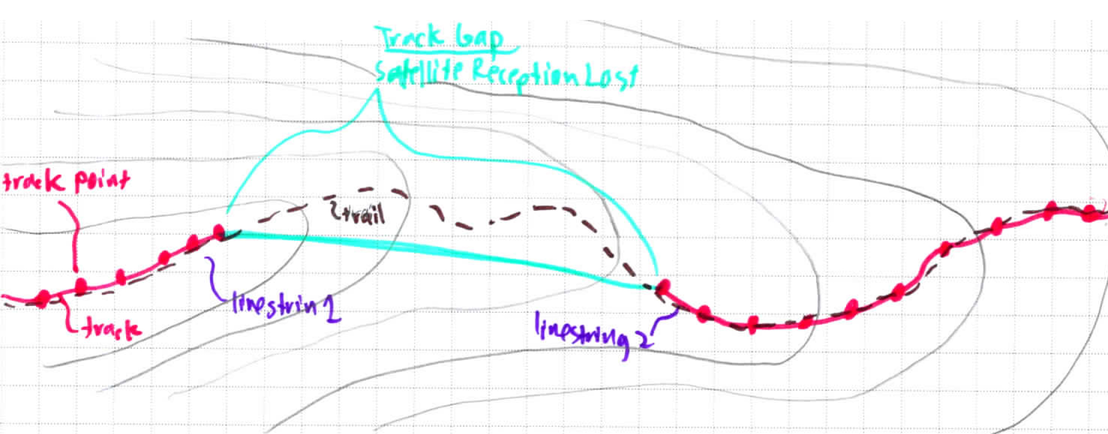
Track gaps occur when satellite reception drops to a level below which a Track can be recorded. This results in gaps in a Track Path, represented as a MultiLineString when the recorded GPX is converted to GeoJSON format.
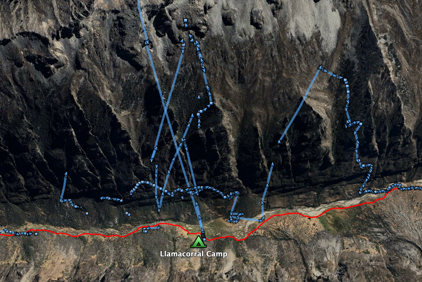
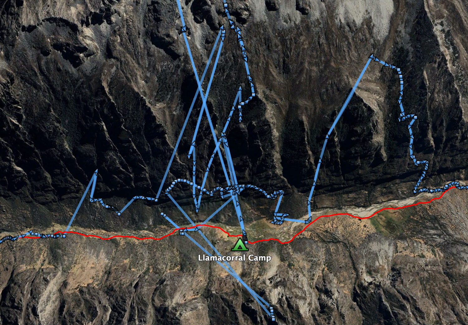
Below is an example of a track gap recorded when hiking in the deep Santa Cruz Valley in the Cordillera Blanca, indicated by gaps, and then after the LineStrings have been merged.
Below shows what the Track looks like after merging the MultiLineString LineStrings into one single LineString (Google Earth does this automatically. So does GIS.ly). However, it is clear that many of the points recorded are inaccurate. More cleaning is needed.
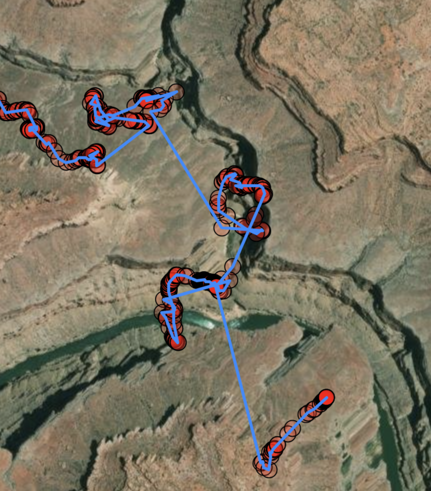
Below is another example, from the Grand Canyon, rendered in GIS.ly, where there were many gaps. GIS.ly automatically merges the tracks, so the blue line in continuous, but you can clearly see the clusters of Track Points that indicate continuous recordings vs. gaps.
This GPS Track is from where 150-Mile Canyon intersects the Colorado River in the Grand Canyon has a lot of cleanup to do. Fortunately, GIS.ly can handle a lot of it automatically. Future versions will be able to do more automatically, while making it easy for manual corrections as well.
Solution
The app addresses this problem by merging the LineStrings into one single LineString between loading the GPX file into a GeoJSON format and creating a Track object with it.


