Sections
Problem
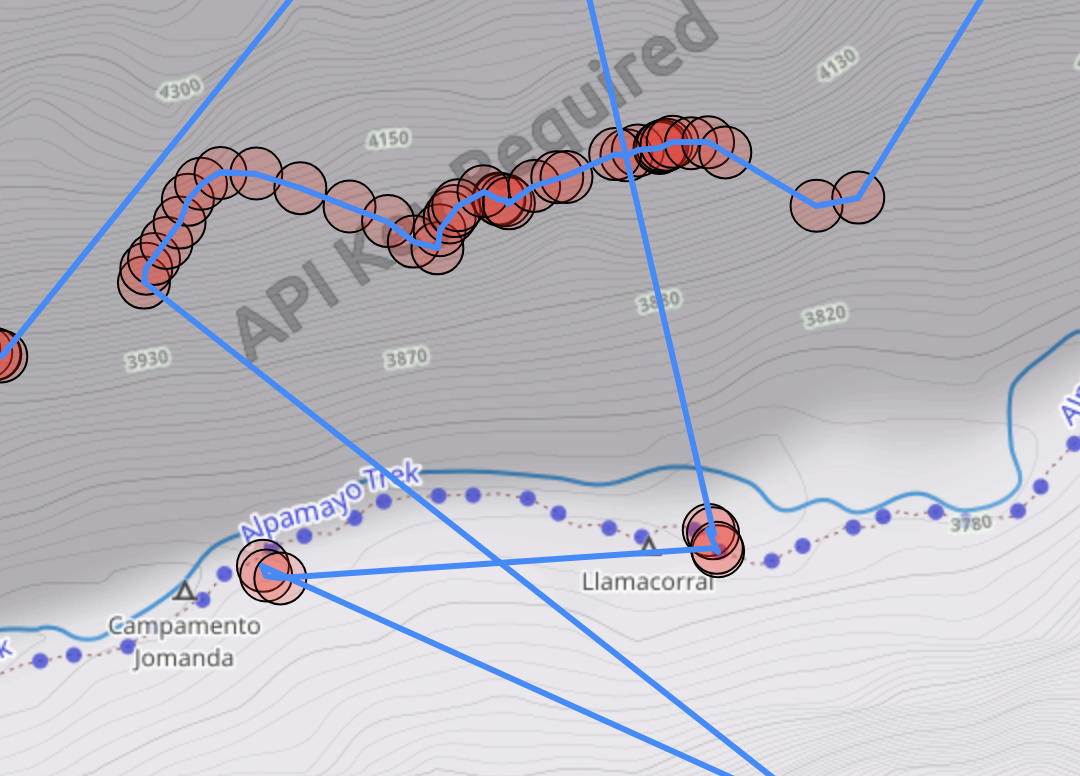
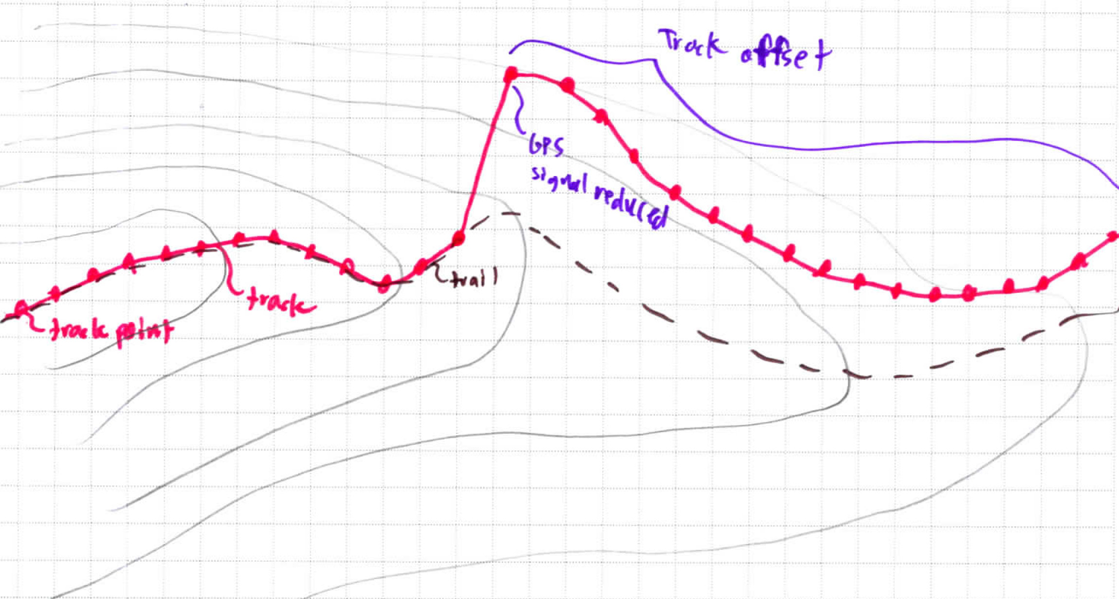
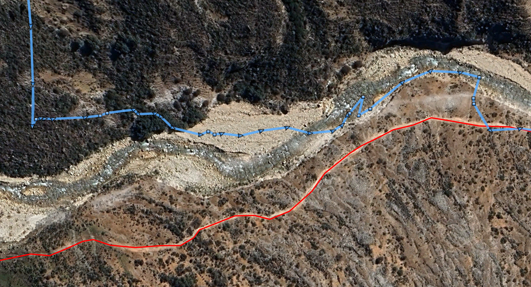
Track Offsets occur when satellite reception is reduced, such that a Track can still be recorded, but the spatial accuracy decreases. This results in a Track shape that is roughly correct, but is offset & skewed from the actual path.

Below are some examples recorded in the Santa Cruz Valley of the Cordillera Blanca:

Solution
Currently the best solution here may be for the user to draw a temporary route along the desired line, with the offset route being ‘snapped’ to it at a spacing that maintains existing speeds.
Another solution in special terrain situations is to utilize the Handrail solution.
Examples
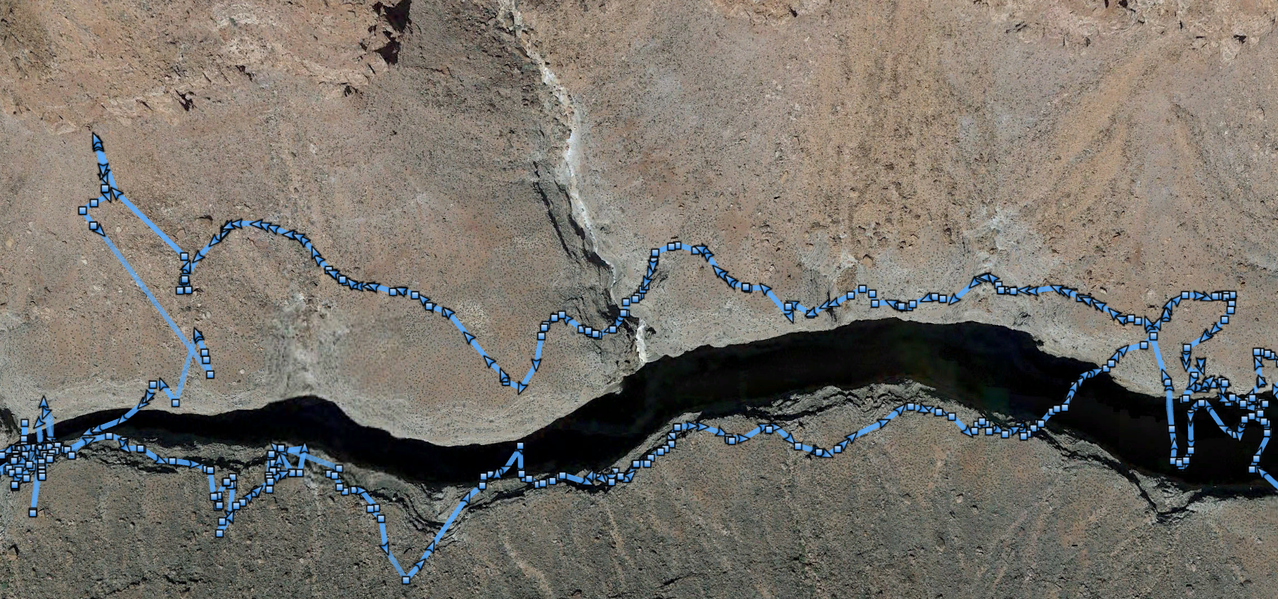
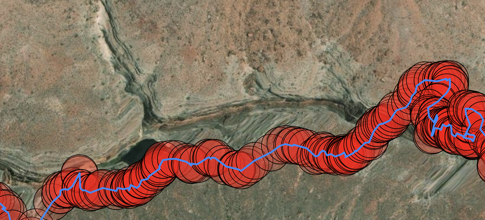
Below are some more examples from a GPX recording from traveling in a deep slot canyon (150-Mile Canyon, in the Grand Canyon):
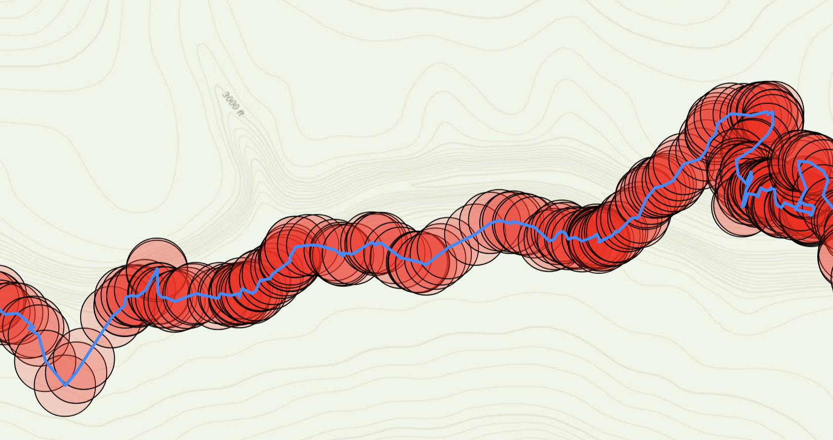
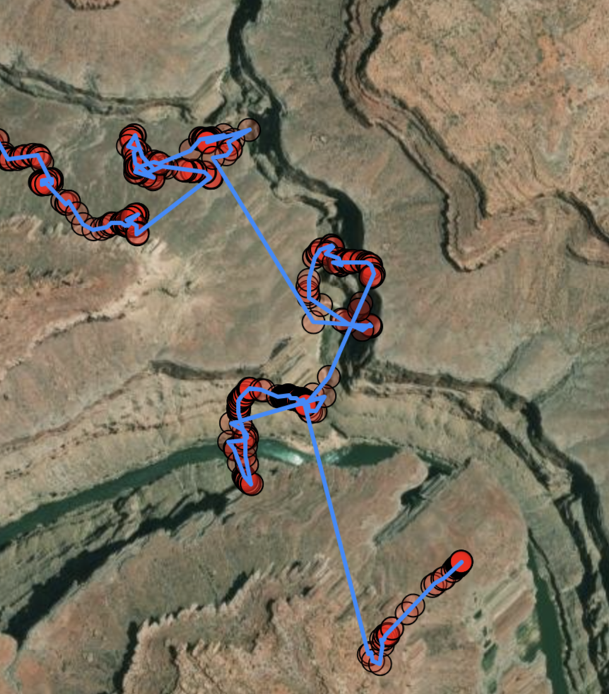
Below is another set, with some insight into potential solutions:
