Sections
Definition
A Route is a single GeoJSON LineString, deriving from a Polyline, comprised of Route Points joined by segments, that represents a Path through space or on the Earth’s surface. They are typically used for documenting or planning routes for a trip, movement, etc. such as a hike or driving route. Point order determines connectivity & Route direction.
Routes are independent of time.
Route Points & Segments
Route Points derive from both Polyline vertices and GeoJSON Points. The only difference from a Point is that there are always at least 2 that form at least 1 segment.
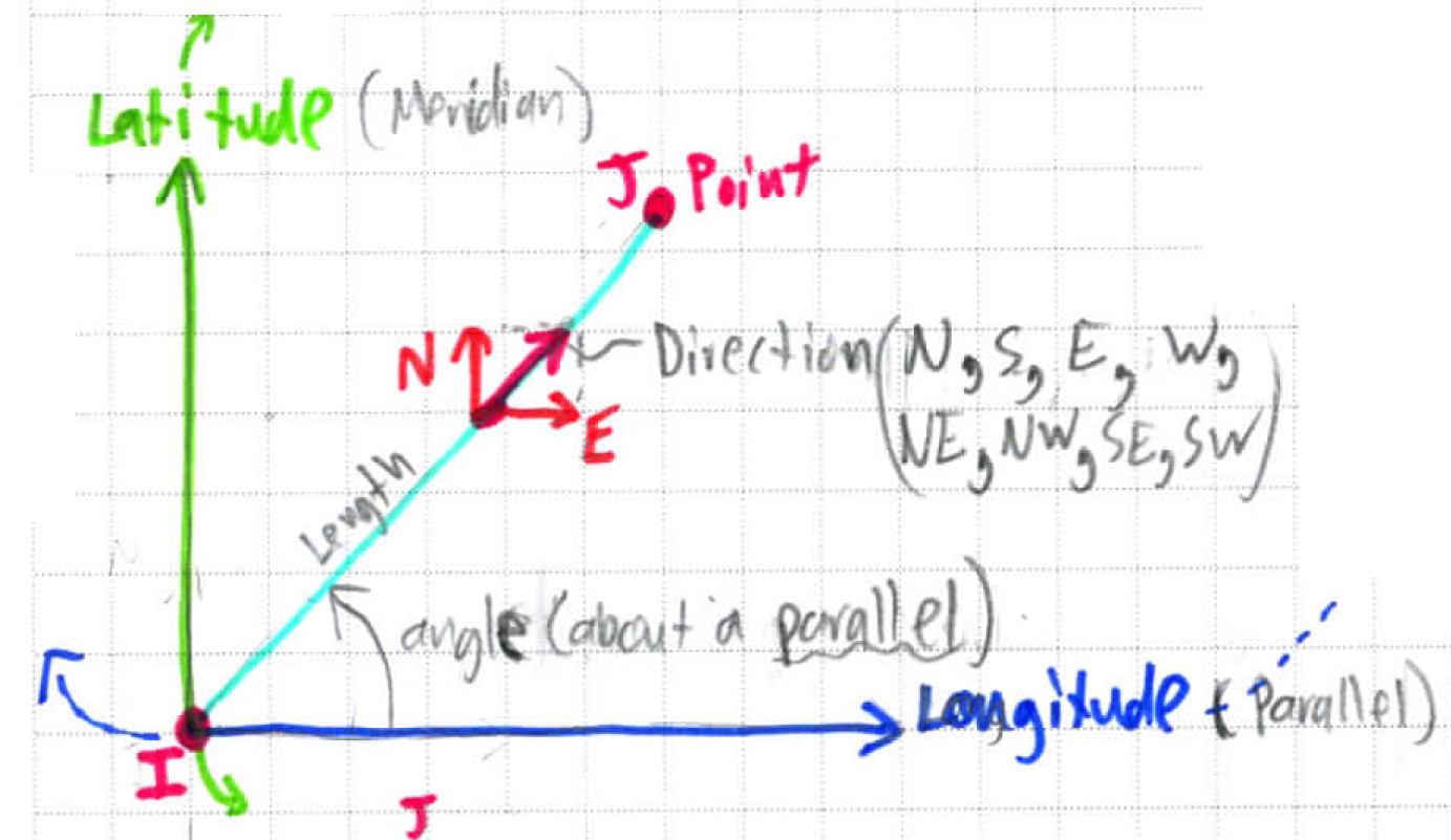
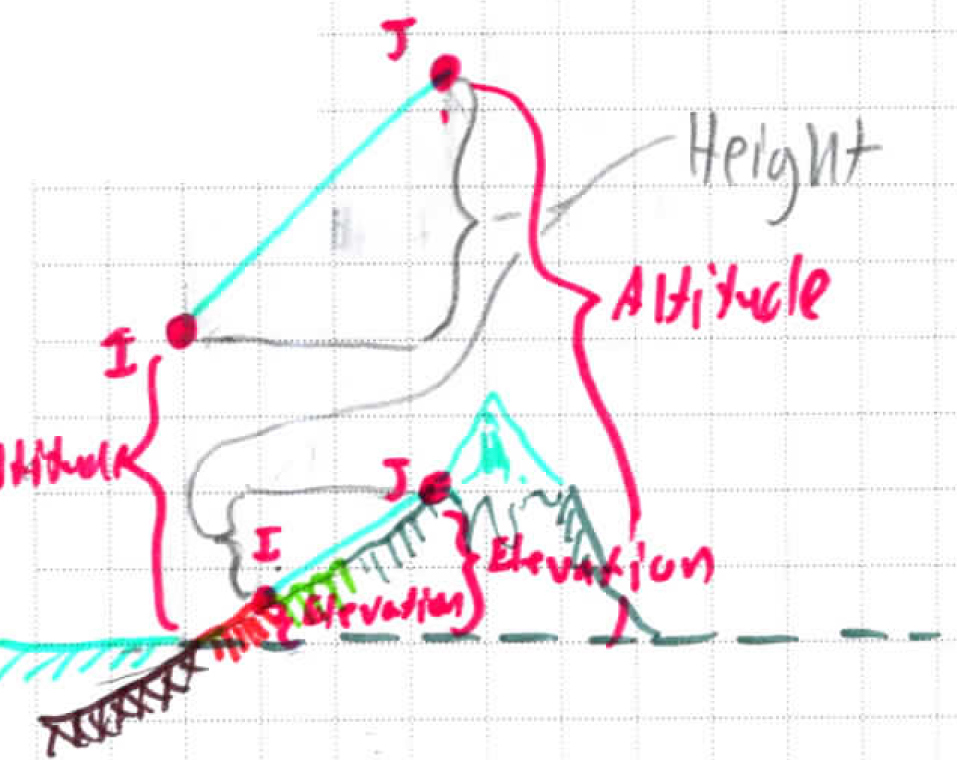
Route Segments derive from Polyline segments and contain properties derived by adjacent Points:
Property | Notes | Diagrams |
|---|---|---|
length | Surface distance between 2 Points, ignoring altitude, at mean sea level | |
angle | 2D angle on a plane tangent to the Earth, between a Parallel & the starting (I) point of a segment. | |
direction | Cardinal direction that the segment is pointing, determined by the angle of a segment & the I/J Point ordering. | |
height | Difference in altitude or elevation of the I/J Points. |
Length
It is important to note that the length between 2 Route Points isn’t a perfectly straight line. It is actually an arc on the Earth’s surface joining 2 Points, whose coordinates describe an angular location on an oblate spheroid.
The equation below is the one that Leaflet uses. The app uses the same equation in order to maintain interoperability. This was validated by comparing differences in results between the two programs for a variety of Points close together & far apart at the equator & poles. Error rates were indicative of nothing more than floating point errors.


