Sections
Introduction
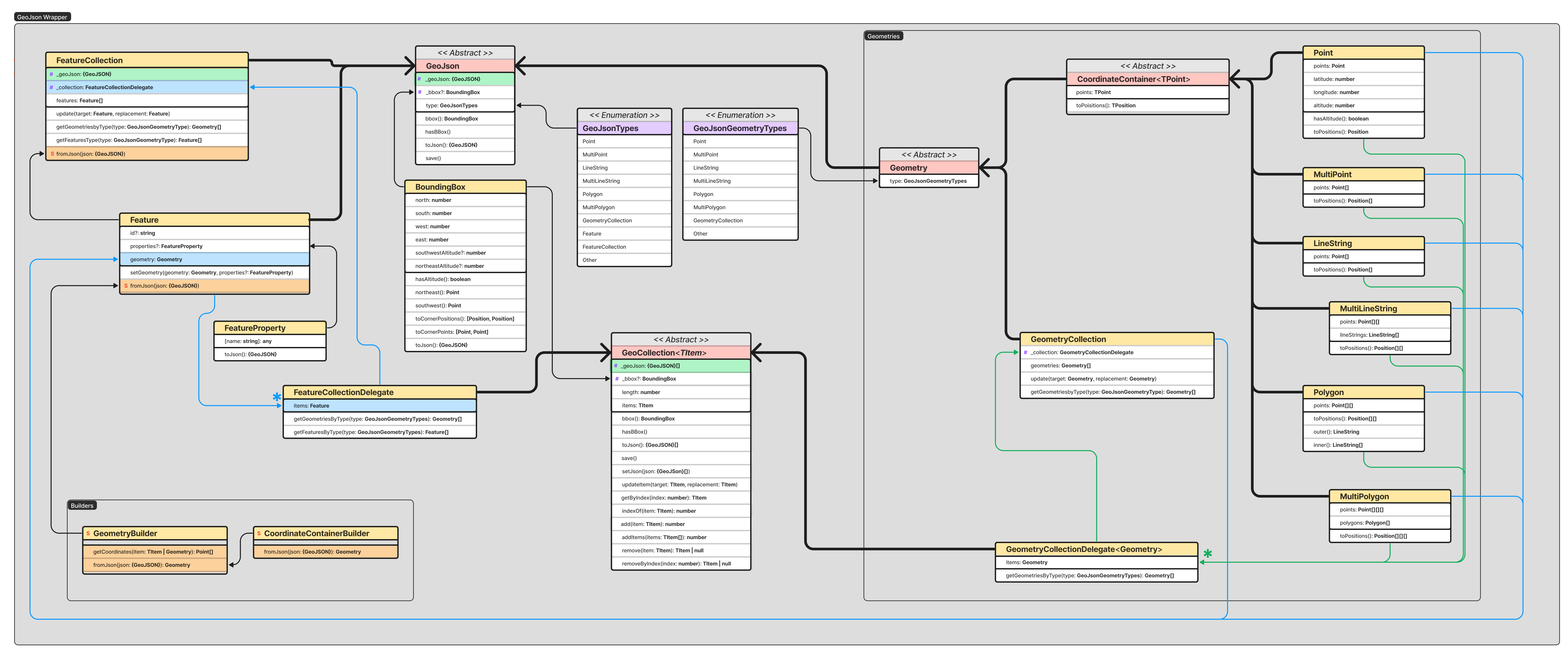
This section contains documentation of how the GeoJSON library is structured & how it works. It further fleshes out glossary terms with more elaboration & diagrams. Most of the classes & terms derive from the GeoJSON Specification (RFC 7946).
This library is in full adherence to this specification except where validation procedures have not yet handled some constraints specified. For these, the user is responsible for providing appropriate data. Future versions of the library will reduce this responsibility on the user or warn them regarding malformed data.
For specific implementations in the library, see the API documentation.
Child Pages
- GeoJSON Bounding Boxes
- GeoJSON Builders
- GeoJSON Collections
- GeoJSON Feature
- GeoJSON FeatureCollection
- GeoJSON Geometries
- GeoJSON Hooks
- GeoJSON I/O
- GeoJSON Position
Class Diagrams
For complete & up to date information, see the API documentation. For a dynamic interactive diagram, see the FigJam diagram.
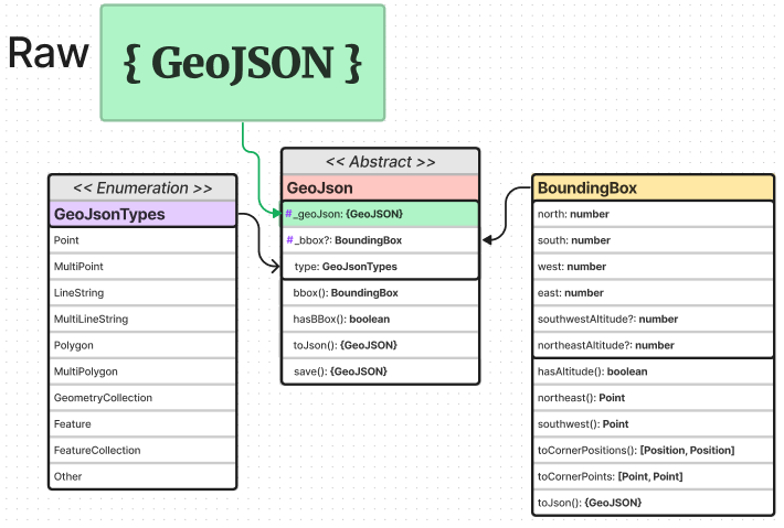
GeoJSON Base Class
The GeoJson abstract class is the base class of the entire library. Nearly every object inherits from it. The fundamental behaviors of this class are defining a GeoJSON type, holding/generating a Bounding Box, serializing to JSON, & hooking/saving to raw JSON objects.

