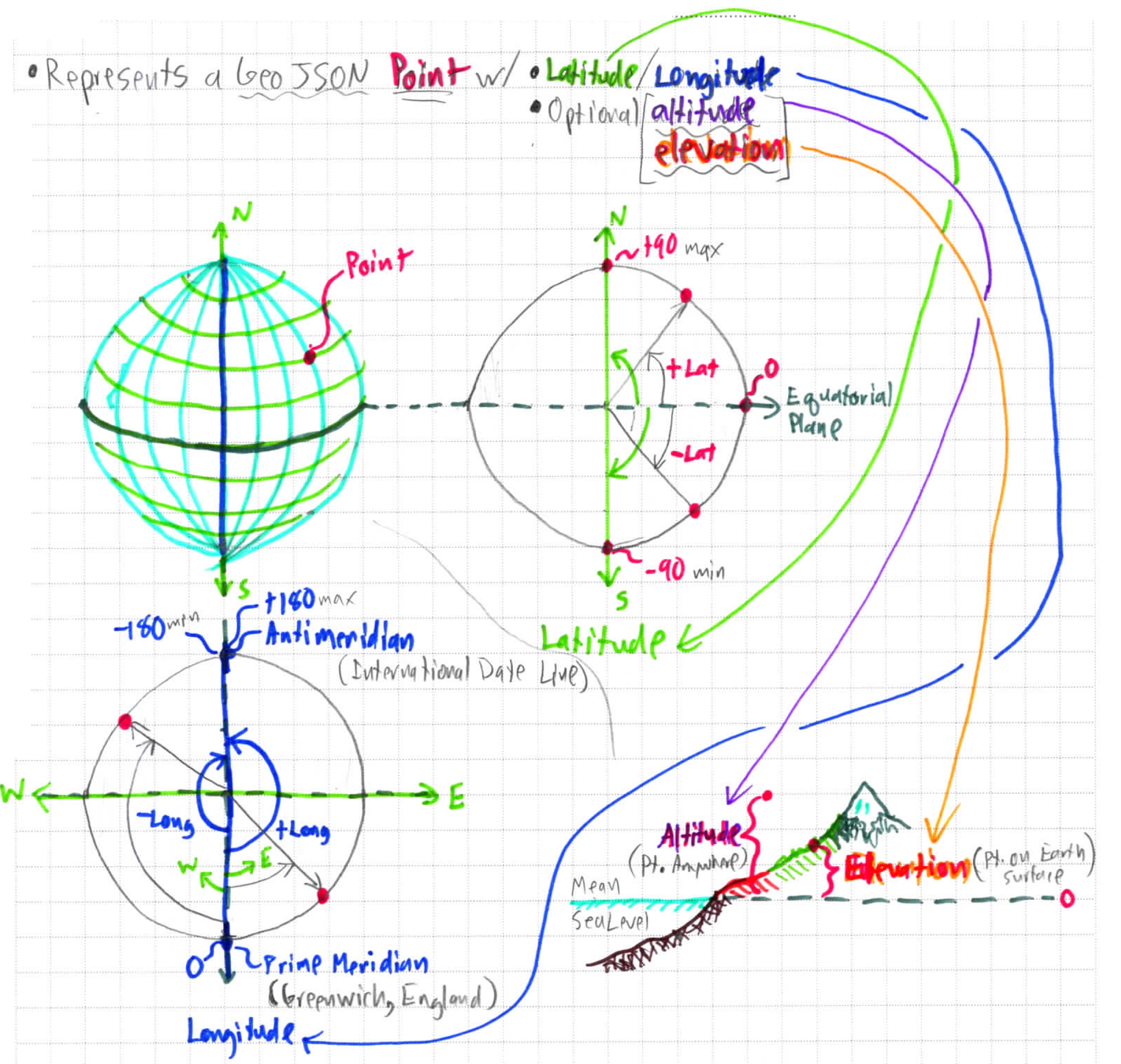
These terms adhere to RFC 7946 - The GeoJSON Format.
Sections
Definition
A Point represents a single geographic Position in terms of decimal latitude & longitude.
This is the most basic GeoJSON geometry object & is immutable. All other more complex geometries store & access Positions as Points.
A GeoJSON object of multiple Points is a MultiPoint geometry.
JSON Example & Class Diagram
Raw GeoJSON
{
   "type": "Point",
   "coordinates": [100.0, 0.0]
 }
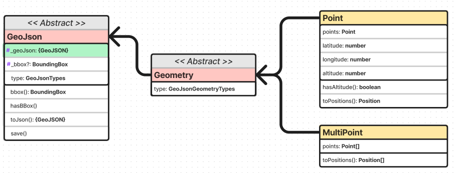
Class Diagram
For complete & up to date information, see the API documentation. For a dynamic interactive diagram, see the FigJam diagram.

