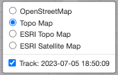
The layers control is used to control the visibility of underlays, Tracks, and other GeoJSON geometries in the session. The first region allows the user to select the desired underlay to display. The second region allows the user to toggle the visibility of individual overlay layers, such as track displays.
