Sections
Introduction
Do you have unwanted TrackPoints in your GPS recording? Did you lose satellite reception in a deep canyon? Did you forget to end your activity for Strava.com before driving home? Well, GIS.ly has you covered for automated & easy manual corrections.
This app deals with GIS (Geographic Information System) oriented tasks using Leaflet & Leaflet-React as a core element of the GUI.
Check out the app at my GitHub repo!

Child Pages
Under Development
Current main feature under development is a GPX track editor that will automatically clean up messy GPX files, addressing the following issues:
Multiple track segments from lost satellite reception or multiple use sessions being merged into one file.
Trimming extra track segments that were not part of the intended recording.
Splitting a GPX file into multiple files for separate days & activities when the GPS was left recording over multiple events/sports. A common case is leaving the recording going after getting in the car & driving somewhere.
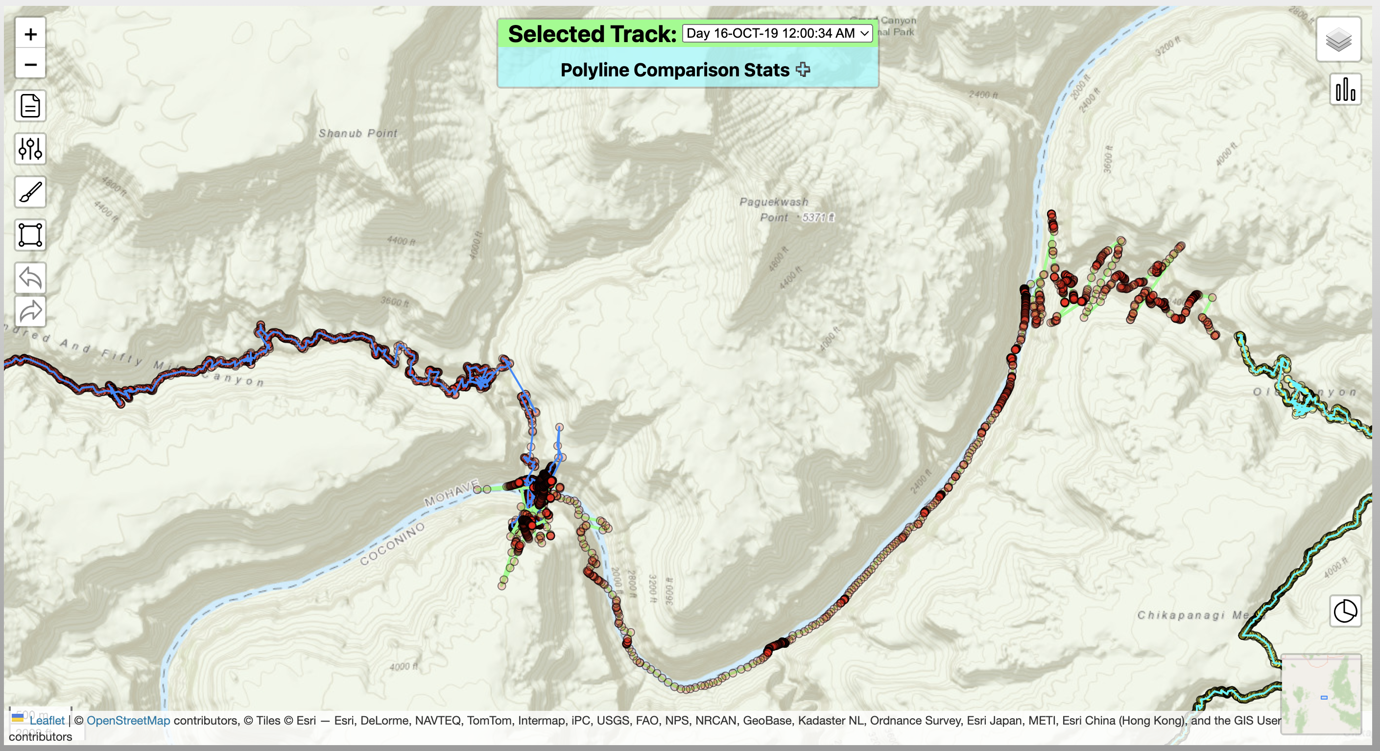
Removing ‘noise clouds’, which comes from 2 cases resulting from GPS error:
GPS is stationary for a long period of time, but small/changing errors still create many points in a small area. This may occur when taking a long lunch break in a deep mountain cirque.
GPS data accuracy is low & changing as satellites are lost/found, resulting in a path moving around far more than the actual GPS device did. This may occur when traveling through a narrow canyon with limited reception.
Coming soon
Trip planning features
Demos
Below are some brief descriptions of the various app components, with animations showing their dynamic behavior.
Track Cleaning
Oftentimes a GPS track will contain inaccurate or unwanted data. The Track.ly portion of GIS.ly allows automated & manual cleaning of the recording.
Trim Cruft
GPS tracks may have some cruft (i.e. unwanted data) at the start or end of the track that come from turning the GPS device on at multiple times without starting a new track. GIS.ly can detect this & automatically remove it. See the Wiki for more information.
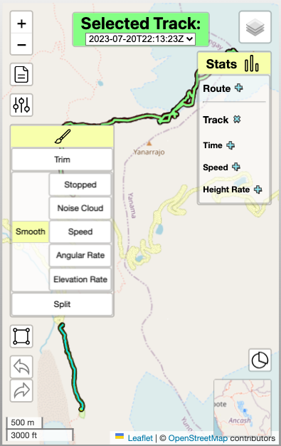
Smooth by Speed
Smoothing refers to the removal of Track Points that are likely to be inaccurate. One way to do this is by determining if the average speed at a point exceeds a realistic speed for the intended activity, such as hiking. See the Wiki for more information.

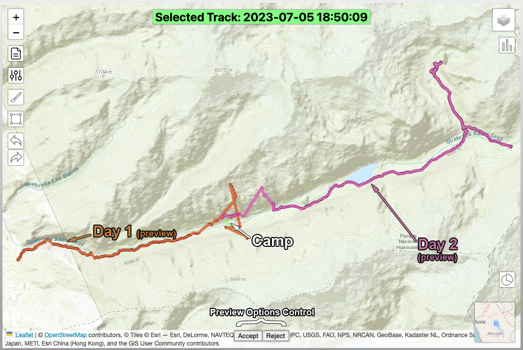
Split by Activity
Did you forget to turn off your GPS device after your bike ride or run, & then drove home? Or what about recording multiple activities, such as in a biathlon or triathlon? GIS.ly can detect when a type of activity has changed & split the track into separate tracks for each activity. See the Wiki for more information.

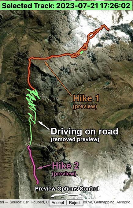
Previews
Although automated cleaning can be nice, and you can always undo operations to tweak settings and try again, it may be nice to see what the affect of an operation will be before committing to it. In GIS.ly , you can preview these effects for a smoother cleaning experience.
Rebuilding Sections of a Track
Editing features are currently under development and will be available in v1.
Sometimes an extended section of a track is offset from a known path. Or perhaps smoothing cleanups have left some large straight segments in your Track. You can manually move, insert or remove Track Points, as well as draw corrections for a segment to rebuild portions of your Track. See the Wiki for more information.
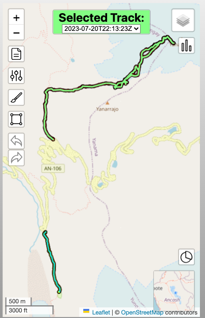
Fluid Layout is Compatible with Mobile Devices
The responsive flow of the layout design and consideration for different screen sizes allows for the app to be usable on a mobile device.
 |  |
|---|