When GPS reception gets spotty, Track Points recorded may be inaccurate. Since these incorrectly show where you went and add to inaccurate stats, it is better to strip out these Points and leave them as gaps in the GPS recording through a set of smoothing operations. Such gaps can be filled in later if needed through future automated & manual editing features.
For example, on this hike that I did in the Santa Cruz Valley of Peru, the deep mountain valleys interfered with the GPS recordings, resulting in many inaccurate points. By smoothing the track, I removed many Points, leaving a smaller file size, and by visual inspection, a more accurate path.
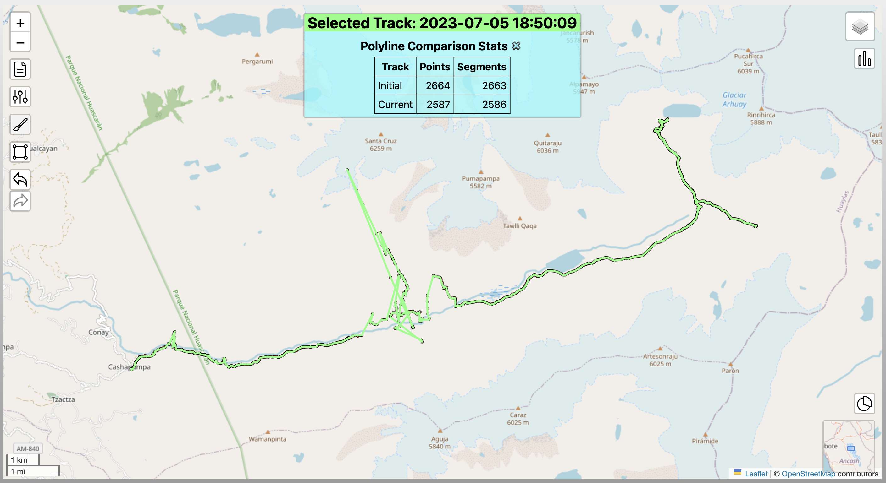
Below is the initial case after some earlier cleaning. At this point we have 2,587 Points. Some of the track is clearly inaccurate, seen by the large zig-zags.
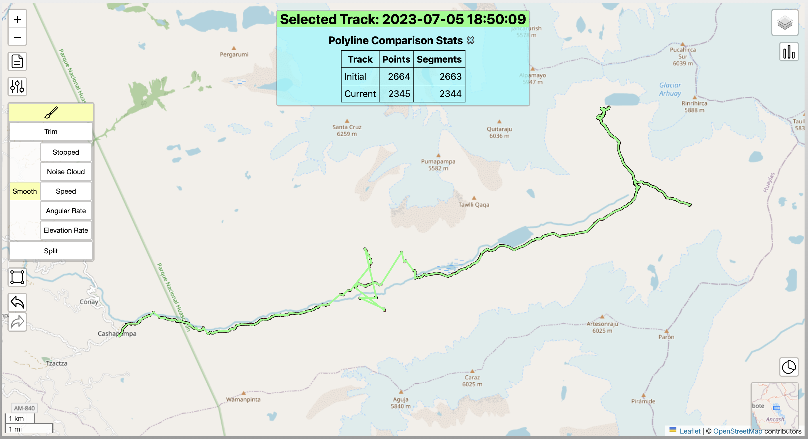
After smoothing by speed, 242 points were removed, reducing the total number of Points to 2,345. The most obviously inaccurate portions of the recording are clearly gone, as seen in the image.
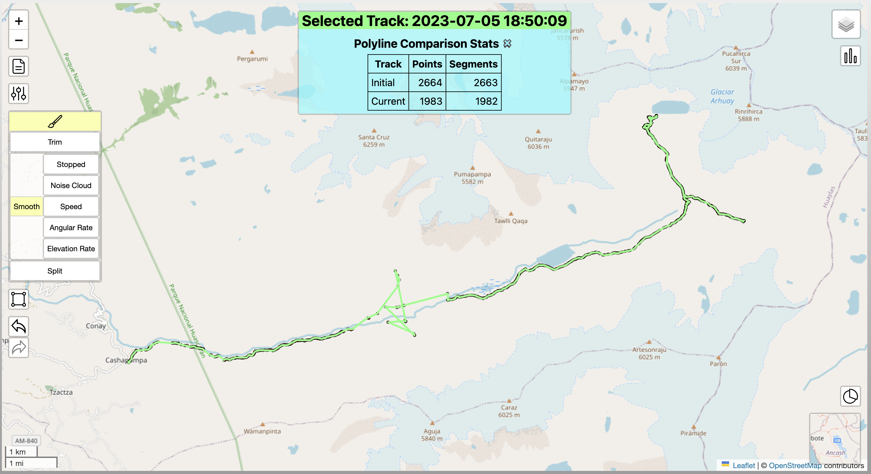
Next in this case, we smoothed by angular rotational speed, removing 2 Points, and elevation gain/loss speeds, removing an additional 360 Points. This has reduced the Track size to 1,983 points, and by visual inspection, even more of the inaccurate points are gone. There are now fewer inaccurate points to address and inaccuracies in the track stats are greatly reduced.
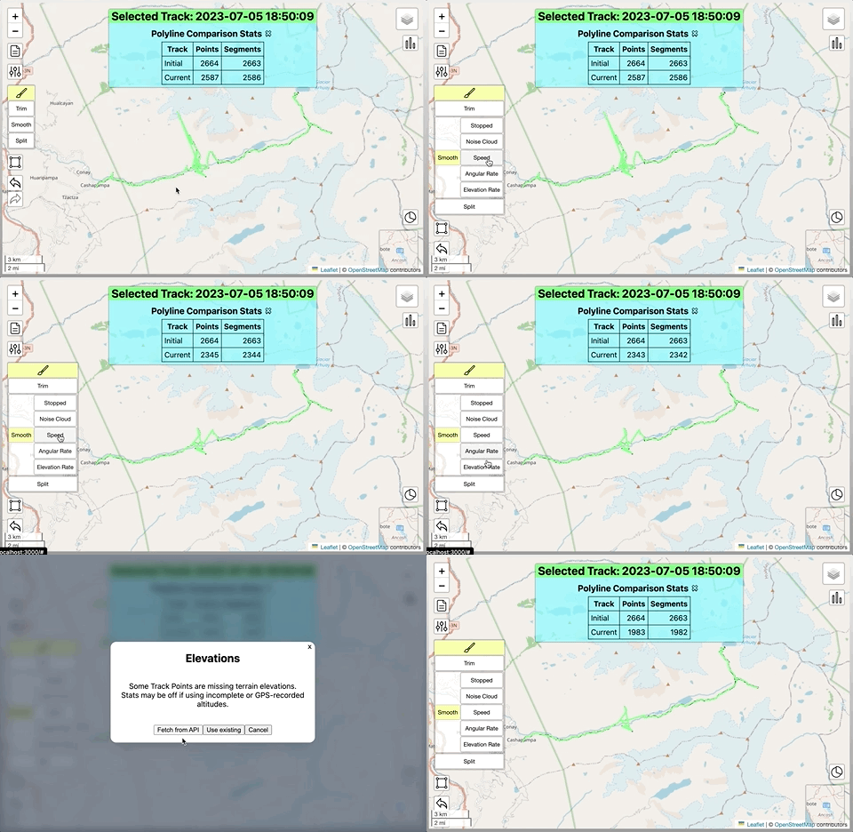
In total, these 3 operations quickly & reliably removed 604 Points, or 23% of the remaining total. Later improvements in the algorithms should remove even more points and leave even fewer to be further cleaned by more rigorous & manual methods.
Below is an animation of the same cleaning process:


